| [1] |
SCHENK T . Introduction to Photogrammetry[G]. Neil Ave, Columbus, OH: The Ohio State University, 2005.
|
| [2] |
GRUEN A . Digital Photogrammetric Imaging-Past, Present and Future[R]. Federal: The Swiss Federal Institutes of Technology (ETH), 2009.
|
| [3] |
BAUMANN P R . History of Remote Sensing, Satellite Imagery, Part Ⅱ[G]. New York, NY: State University of New York, 2009.
|
| [4] |
ZHANG Yun . Ten years of Technology Advancement in Remote Sensing and The Research in the CRC-AGIP Lab in GGE[J]. Geomatica, 2010,64(2):173-189.
|
| [5] |
ZHANG Y . Highlight Article:Understanding Image Fusion[J]. Photogrammetric Engineering and Remote Sensing, 2004,70(6):657-661.
|
| [6] |
ZHANG Yun, MISHRA R . From UNB PanSharp to Fuze Go-the Success Behind the Pansharpening Algorithm[J]. International Journal of Image and Data Fusion, 2014,5(1):39-53.DOI: 10.1080/19479832.2013.848475
|
| [7] |
ZHANG Yun, ROSHAN A, JABARI S , et al. Understanding the Quality of Pansharpening:A Lab Study[J]. Photogrammetric Engineering & Remote Sensing, 2016,82(10):747-755.
|
| [8] |
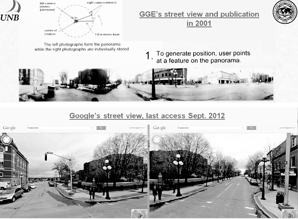
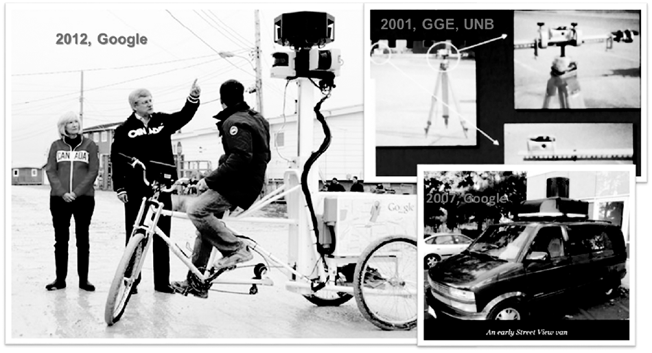
RAWLINSON S, LEE Y C, ZHANG Y . Development of a Software Prototype for the Geo-referencing and Visualization of Non-metric TERRESTRIAL Photography in a GIS Environment [C]//Proceedings of the 23rh to 27th ASPRS 2001 Annual Conference. St. Louis, Missouri: ASPRS, 2001.
|
| [9] |
LEVITZ S. Putting the North on the Map: Google Recruits Northerners for Help with Maps[M]. [S. l. ]: The Canadian Press, 2012.
|
| [10] |
GANNES L . Ten Years of Google Maps, From Slashdot to Ground Truth[EB/OL]. [2015-02-08]. https://www.recode.net/2015/2/8/11558788/ten-years-of-google-maps-from-slashdot-to-ground-truth .
|
| [11] |
XIONG Zhen, ZHANG Yun . A Novel Interest Point Matching Algorithm for High Resolution Satellite Images[J]. IEEE Transactions on Geoscience and Remote Sensing, 2009,47(12):4189-4200. DOI: 10.1109/TGRS.2009.2023794
|
| [12] |
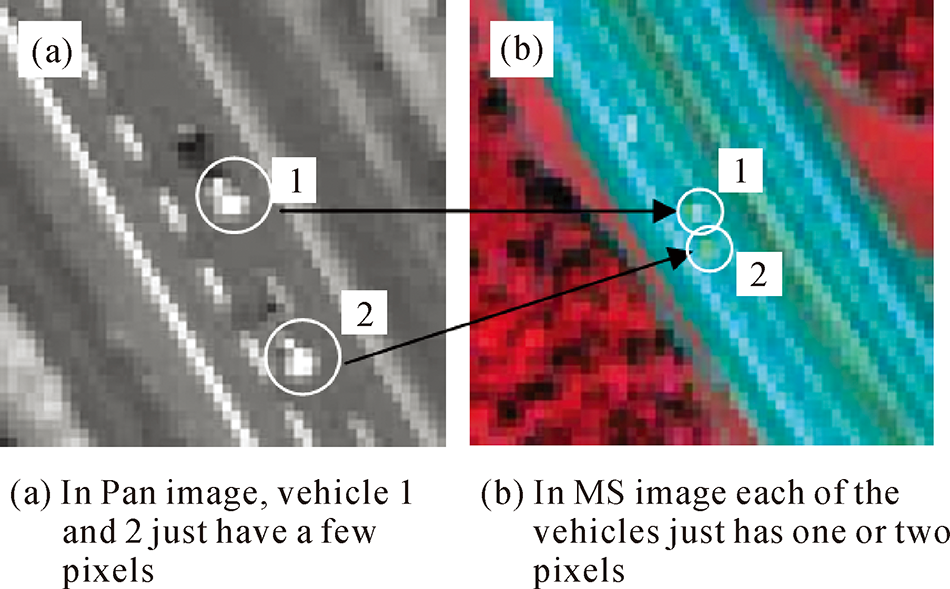
XIONG Zhen, ZHANG Yun . An Initial Study on Vehicle Information Extraction from Single Pass of Satellite QuickBird Imagery[J]. Photogrammetric Engineering and Remote Sensing, 2008,74(11):1401-1412. DOI: 10.14358/PERS.74.11.1401
|
| [13] |
ZHANG Yun, MAXWELL T . A Fuzzy Logic Approach to Optimization of Segmentation of Object-Oriented Classification [C]//Proceedings of SPIE 50th Annual Meeting-Optics & Photonics 2005. San Diego, California, USA: SPIE, 2005.
|
| [14] |
TONG Hengjian, MAXWELL T, ZHANG Yun , et al. A Supervised and Fuzzy-based Approach to Determine Optimal Multi-resolution Image Segmentation Parameters[J]. Photogrammetric Engineering & Remote Sensing, 2012,78(10):1029-1044.
|
| [15] |
JABARI S, ZHANG Yun . RPC-Based Coregistration of VHR Imagery for Urban Change Detection[J]. Photogrammetric Engineering & Remote Sensing, 2016,82(7):521-534.
|