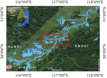
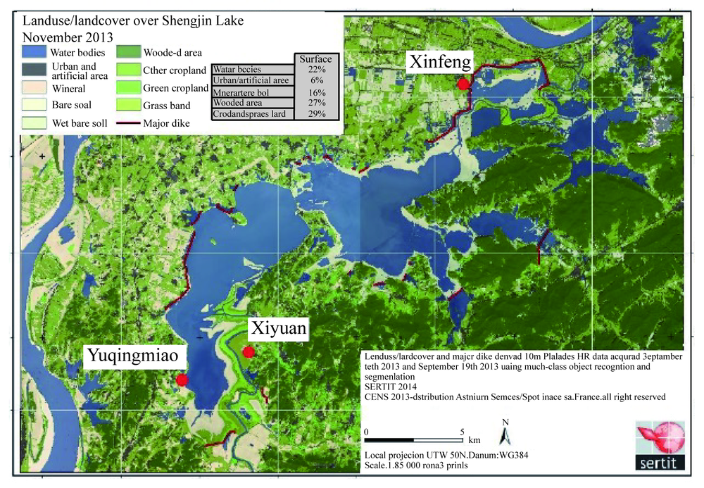
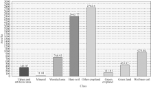
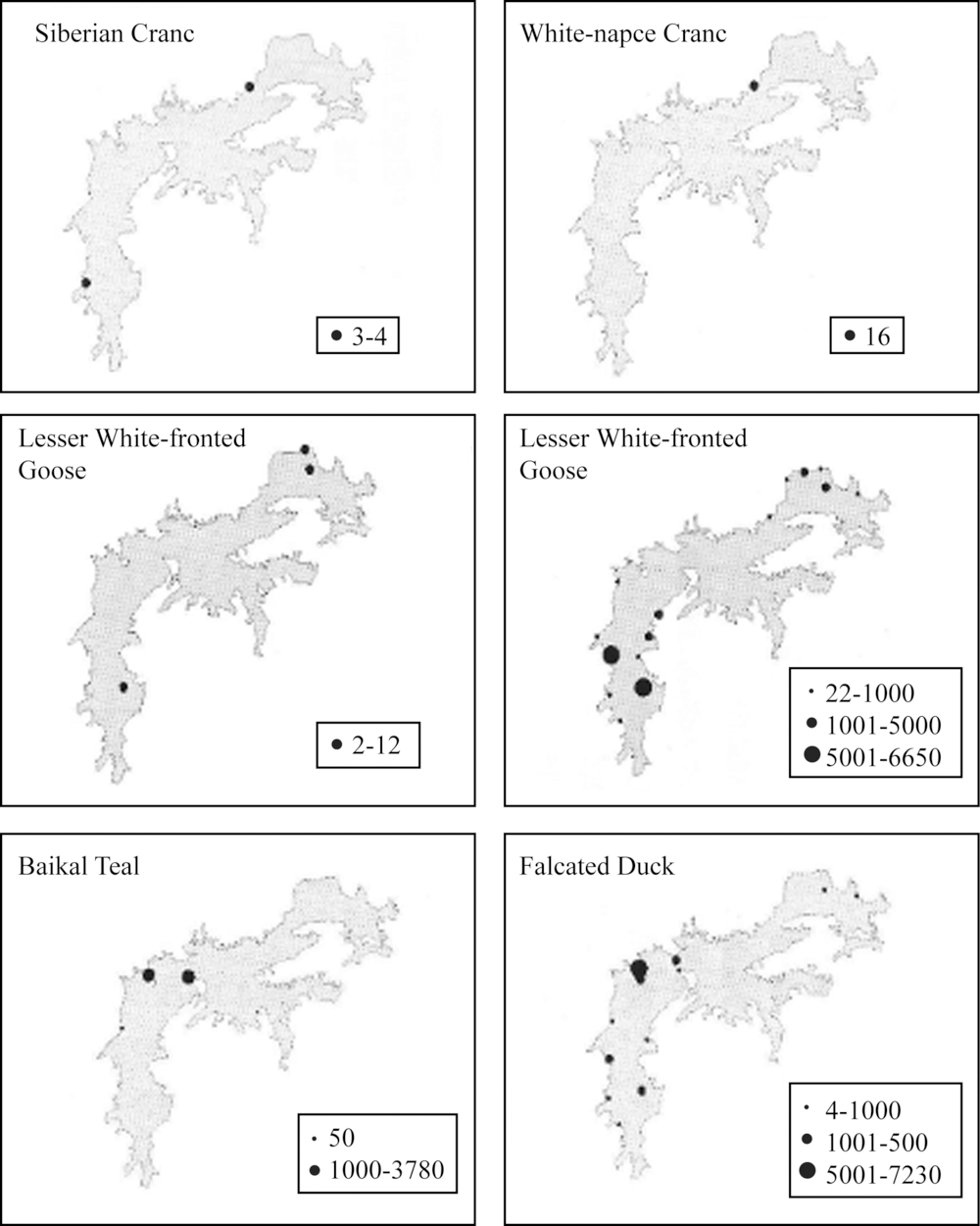
| [1] |
BARTERM, CAO L, CHEN L, et al. Results of a survey for waterbirds in the lower Yangtze floodplain, China, in January-February 2004[J]. Forktail, 2005,21.
|
| [2] |
CHENG Y Q, CAO L, BARTER M, et al. Wintering waterbird survey at the Anhui Shengjin Lake National Nature Reserve, China 2008/9[J]. Journal of University of Science and Technology of China, 2009.
|
| [3] |
CAO L, ZHANG Y, BARTER M, et al. Anatidae in eastern China during the non-breeding season: Geographical distributions and protection status[J]. Biological Conservation, 2010,143(3):650-659.
|
| [4] |
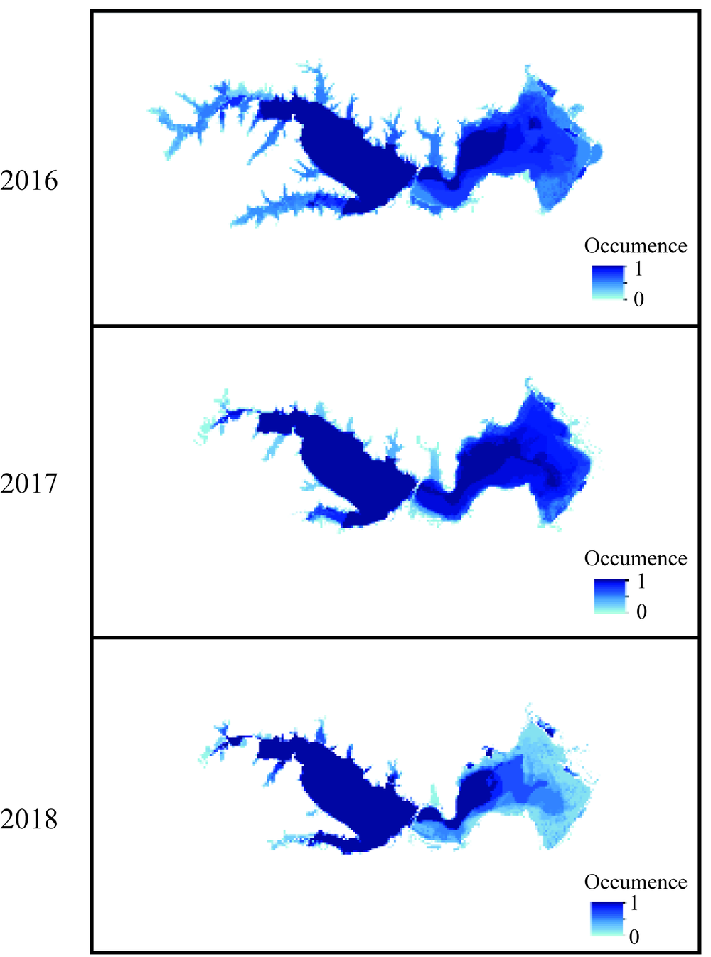
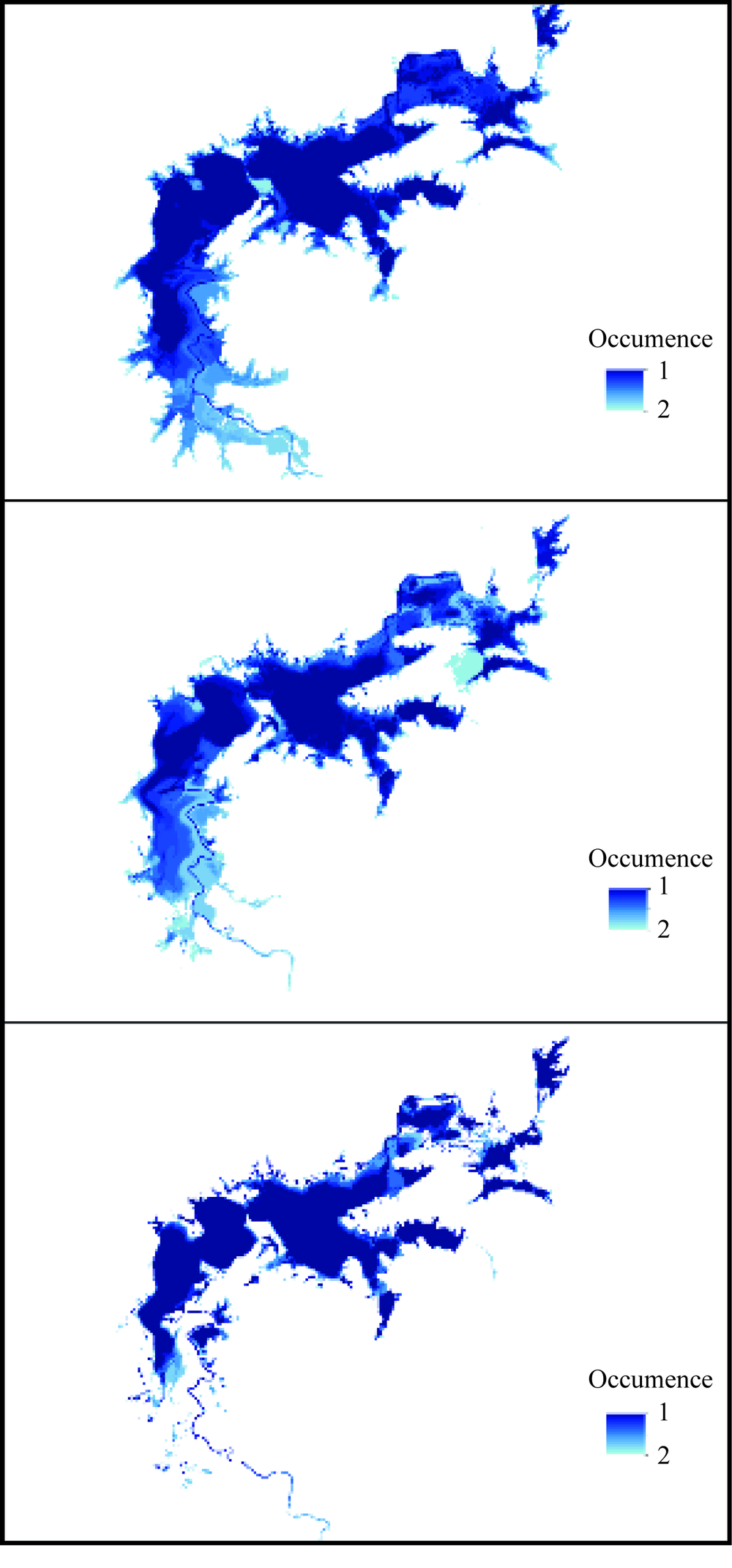
ZHANG Xiaoke, WAN An, WANG Huili, et al. The overgrowth of Zizania latifolia in a subtropical floodplain lake: Changes in its distribution and possible water level control measures[J]. Ecological Engineering, 2016,89:114-120.
|
| [5] |
JIA Q, CAO L, YÉSOU H, et al. Combating aggressive macrophyte encroachment on a typical Yangtze River lake: lessons from a long-term remote sensing study of vegetation[J]. Aquatic Ecology, 2016.
pmid: 21516253
|
| [6] |
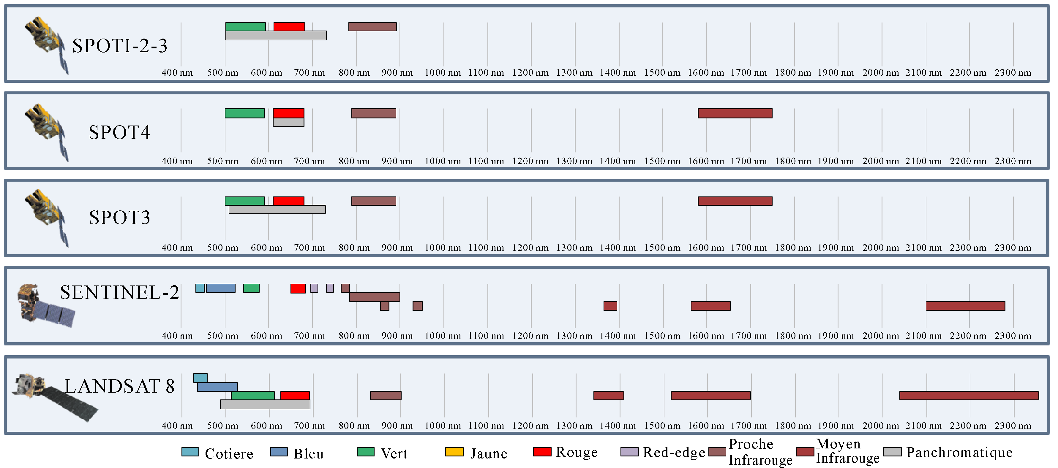
DRUSCH M, DEL BELLO U, CARLIER S, et al. Sentinel-2: ESA’s optical high-resolution mission for GMES operational services[J]. Remote sensing of Environment, 2012,120:25-36.
|
| [7] |
XU Hanqiu. Modification of normalised difference water index (NDWI) to enhance open water features in remotely sensed imagery[J]. International Journal of Remote Sensing, 2006,27(12/14):3025-3033.
|
| [8] |
YÉSOU H, POTTIER É, MERCIER G, et al. Synergy of Sentinel-1 and Sentinel-2 imagery for wetland monitoring information extraction from continuous flow of sentinel images applied to water bodies and vegetation mapping and monitoring [C]//2016 IEEE International Geoscience and Remote Sensing Symposium (IGARSS). Beijing: IEEE, 2016: 162-165.
|
| [9] |
HUBER C, BATTISTON S, YÉSOU H, et al. Synergy of VHR pleiades data and SWIR spectral bands for flood detection and impact assessment in urban areas: Case of Krymsk, Russian Federation, in July 2012 [C]//2013 IEEE International Geoscience and Remote Sensing Symposium-IGARSS. Australia: IEEE, 2013: 4538-4541.
|
| [10] |
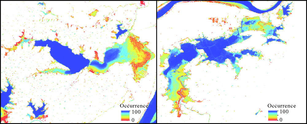
PEKEL J F, COTTAM A, GORELICK N, et al. High-resolution mapping of global surface water and its long-term changes[J]. Nature, 2016,540(7633):418-422.
doi: 10.1038/nature20584
pmid: 27926733
|
| [11] |
AKAIKE H. Information theory and an extension of the maximum likelihood principle[M] //Selected papers of hirotugu akaike. New York: Springer, 1998: 199-213.
|
| [12] |
YUAN Yuan, GAO Hui, LI Weijing, et al. The 2016 summer floods in China and associated physical mechanisms: A comparison with 1998[J]. Journal of Meteorological Research, 2017,31(2):261-277.
|
| [13] |
ZHANG Y, CAO L, BARTER M, et al. Changing distribution and abundance of Swan Goose Anser cygnoides in the Yangtze River floodplain: the likely loss of a very important wintering site[J]. Bird Conservation International, 2011,21(1):36-48.
|

 ),Huber CLAIRE1,Studer MATHIAS1,Lei CAO2,Kunpeng YI2,Yésou HERVÉ1